Social Media was abuzz yesterday after a helicopter had been spotted making dozens of passes in the skies above Geelong
One person claimed “Big Brother is watching” in a Geelong Facebook group, with some suspicious locals making claims of drug detectors and the Council looking for pools installed without a permit.
But the real reason is far less sinister, Powercor is conducting its yearly vegetation inspection program.
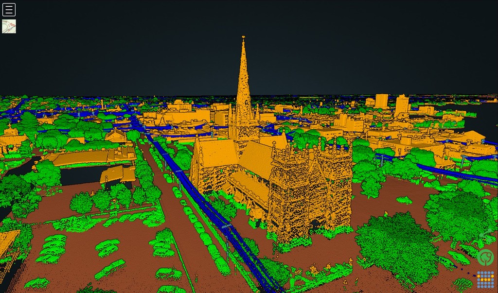
Helicopters, fitted with Light Detection and Ranging (LiDAR) technology maps out a 3D model of vegetation to accurately identify the distance between tree branches and powerlines.
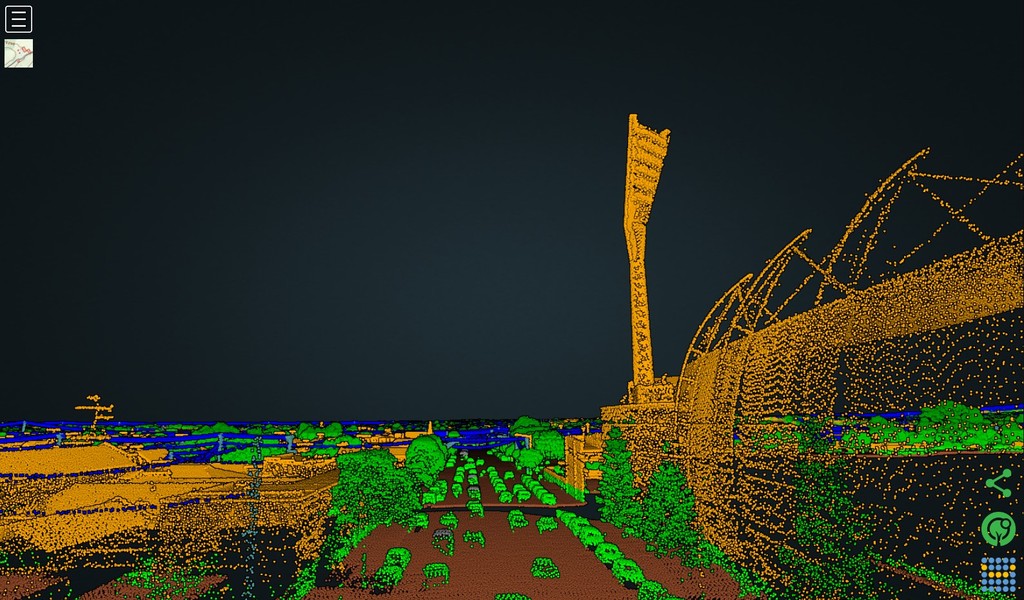
A whopping 1TB of data is captured and processed every day.
The information is then used to plan trimming and other efforts to avoid power outages caused by falling branches or other vegetation impacts on the power grid.
Chris Heinz, head of Vegetation Management at Powercor said the helicopters fly at an altitude of just 300 metres
“Our work is about reducing the risk of trees and branches coming into contact with powerlines, which can lead to power outages and fires”.
“By inspecting the entire network every year, we are able to determine where and when we need to cut trees and branches away from powerlines,”
On Monday, a helicopter conducted two, two-hour flights out of Avalon. The Bell 505 has a range of just over 600km, and can hit a top speed of 232km/h, but slows to under 130km/h when undertaking LiDAR capturing.
Images:
Main: Digitally altered image including tracking data from multiple flights obtained from Flight Aware, incorporating satellite imagery from Mapbox and OpenStreetMap [Flight Aware]
Story images: screenshots of the LiDAR 3D mapping of Kardinia Park and St Mary’s Basilica [Powercor]